Detailed instructions for use are in the User's Guide.
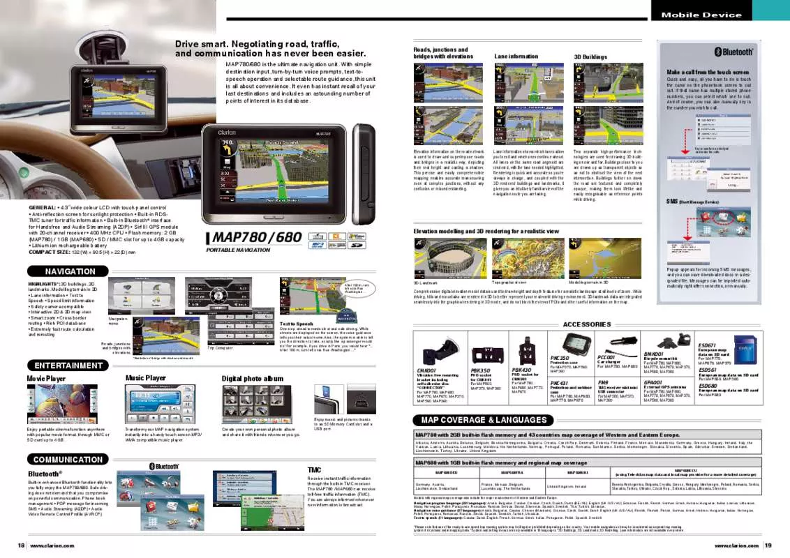
[. . . ] Negotiating road, traffic, and communication has never been easier. mAP780/680 is the ultimate navigation unit. With simple destination input, turn-by-turn voice prompts, text-tospeech operation and selectable route guidance, this unit is all about convenience. [. . . ] 3˝ wide colour LCD with touch panel control • Anti-reflection screen for sunlight protection • Built-in RDSTMC tuner for traffic information • Built-in Bluetooth® interface for Handsfree and Audio Streaming (A2DP) • Sirf III GPS module with 20-channel receiver • 400 MHz CPU • Flash memory: 2 GB (MAP780) / 1 GB (MAP680) • SD / MMC slot for up to 4GB capacity • Lithium ion rechargeable battery COMPACT SIZE: 132 (W) × 90. 5 (H) × 22 (D) mm
Two separate high-performance technologies are used for drawing 3D buildings near and far. Buildings close to you are drawn up as transparent objects so as not to obstruct the view of the next intersection. Buildings further on down the road are textured and completely opaque, making them look lifelike and easily recognisable as reference points while driving. Key in numbers on dial pad and make the calls. While driving, hills and mountains are rendered in 3D to better represent your real world driving environment. 3D landmark data are integrated seamlessly into the graphical rendering in 3D mode, and do not block the view of POIs and other useful information on the map. Popup appears for incoming SMS messages, and you can save downloaded docs in a designated file. Messages can be imported automatically right after connection, or manually. Navigation menu
Text to Speech
Roads, junctions and bridges with elevations
Trip Computer
*Illustration of bridge with shadow underneath
One step ahead towards clear and safe driving. While streets are displayed on the screen, the voice guidance tells you their actual name. Also, the system is able to tell you the direction to take, exactly like a passenger would do!For example, if you drive in Paris, you would hear ". After 100 m, turn left onto Rue Washington…"
ACCESSORIES
ESD671 PNC350
Protection case For MAP370, MAP560, MAP360
Movie Player
ENTERTAINMENT
PCC001
BMK001
Music Player
Digital photo album
CMK001
Vibration free mounting bracket including self-adhesive disc “CONNECTOR” For MAP780, MAP680, MAP770, MAP670, MAP370, MAP560, MAP360
PBK350
PND socket for CMK001 For MAP560, MAP370, MAP360
PBK430
Car charger For MAP780, MAP680
PND socket for CMK001 For MAP780, MAP680, MAP770, MAP670
Bicycle mount kit For MAP780, MAP680, MAP770, MAP670, MAP370, MAP560, MAP360
European map data on SD card For MAP770, MAP670, MAP370
ESD561
PNC431
Protection and outdoor case For MAP780, MAP680, MAP770, MAP670
FM9
TMC receiver whit mini USB connector For MAP560, MAP370, MAP360
GPA001
European map data on SD card For MAP560, MAP360
External GPS antenna For MAP780, MAP680, MAP770, MAP670, MAP370, MAP560, MAP360
ESD680
European map data on SD card For MAP680
Enjoy portable cinema function anywhere with popular movie format, through MMC or SD card up to 4 GB. Transform your MAP navigation system instantly into a handy touch screen MP3/ WMA compatible music player. Create your own personal photo album and share it with friends wherever you go. [. . . ] Models with regional map coverage also include the major road network of Western and Eastern Europe. Navigation program language (32 languages): Arabic, Bulgarian, Catalan, Croatian, Czech, Danish, Dutch (BE / NL), English (UK / US / AU), Estonian, Finnish, French, German, Greek, Hebrew, Hungarian, Italian, Latvian, Lithuanian, Malay, Norwegian, Polish, Portuguese, Romanian, Russian, Serbian, Slovak, Slovenian, Spanish, Swedish, Thai, Turkish, Ukrainian, Navigation voice guidance (27 languages): Arabic, Bulgarian, Catalan, Chinese (Mandarin), Croatian, Czech, Danish, Dutch, English (UK / US / AU), Finnish, Flemish, French, German, Greek, Hebrew, Hungarian, Italian, Norwegian, Polish, Portuguese, Romanian, Russian, Slovak, Spanish, Swedish, Turkish, Ukrainian, Text to speech (11 languages): Catalan, Dutch, English, French, German, Greek, Italian, Portuguese, Polish, Spanish, Swedish *Please note that use of the ready-to use speed trap warning system may be illegal or prohibited depending on the country. Your mobile navigation unit may be considered as a speed trap warning system if it contains radar mapping data. [. . . ]


