User manual GARMIN DC 40
Lastmanuals offers a socially driven service of sharing, storing and searching manuals related to use of hardware and software : user guide, owner's manual, quick start guide, technical datasheets... DON'T FORGET : ALWAYS READ THE USER GUIDE BEFORE BUYING !!!
If this document matches the user guide, instructions manual or user manual, feature sets, schematics you are looking for, download it now. Lastmanuals provides you a fast and easy access to the user manual GARMIN DC 40. We hope that this GARMIN DC 40 user guide will be useful to you.
Lastmanuals help download the user guide GARMIN DC 40.
Manual abstract: user guide GARMIN DC 40
Detailed instructions for use are in the User's Guide.
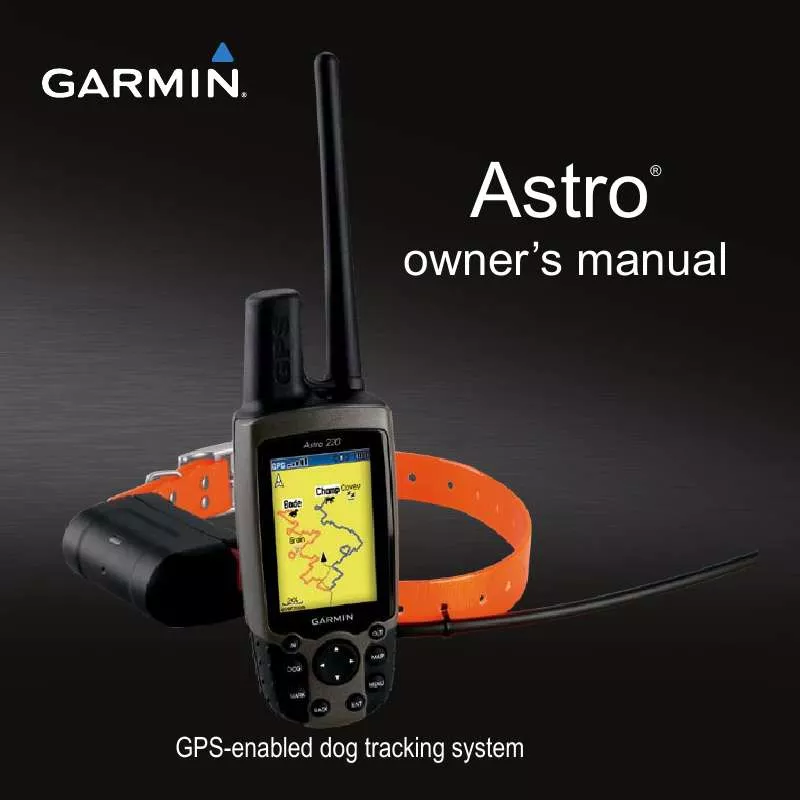
[. . . ] owner's manual
Astro
®
GPS-enabled dog tracking system
© 2010 Garmin Ltd. or its subsidiaries All rights reserved. Except as expressly provided herein, no part of this manual may be reproduced, copied, transmitted, disseminated, downloaded or stored in any storage medium, for any purpose without the express prior written consent of Garmin. Garmin hereby grants permission to download a single copy of this manual onto a hard drive or other electronic storage medium to be viewed and to print one copy of this manual or of any revision hereto, provided that such electronic or printed copy of this manual must contain the complete text of this copyright notice and provided further that any unauthorized commercial distribution of this manual or any revision hereto is strictly prohibited. [. . . ] · Lock On Road--locks the position pointer to the nearest road. Tracks Page · Saved Tracks--sets the maximum zoom at which saved tracks are shown. · Track Log--sets the maximum zoom at which active track logs are shown.
Astro and DC 40 Owner's Manual
· Track Points--sets the maximum number of track points used to record a track. · Go To Line--allows you to select either a bearing line or a course line (page 28) to navigate a track. Points Page You can customize the maximum zoom level for map points, marked locations, street labels, and land cover. Text Page You can customize the text size for the descriptions of map items. Information Page You can view the list of optional detailed maps.
Customizing Your Detailed Maps
· Select a check box to enable a detailed map. · Press MENU to select options for hiding or showing maps.
4
Customizing Your Device
Marine Page If you are using optional marine charts or marine maps, you can customize how the map displays the marine features. · Marine Colors--enables marine colors on the map. · Spot Soundings--enables spot soundings that indicate depth measurements on the map. · Light Sectors--sets navigational light locations to On, Off, or Auto (the location appears when the map pointer passes over it). · Symbol Set--allows you to select the map symbol set: Auto, GARMIN, NOAA, or International.
routing Settings
From the main menu, select Advanced > Settings > Routing. · Guidance Method--allows you to select a guidance method for calculating your route. Prompted--asks you to select a routing method before the route is calculated. Follow Road--creates a route that overlays the roads on the map. Off Road--creates a point-topoint route. · Follow Road Method Prompted--asks you to select a follow-road method before the route is calculated.
4
Astro and DC 40 Owner's Manual
Customizing Your Device
Faster Time--calculates routes that are faster to drive but can be longer in distance. Shorter Distance--calculates routes that are shorter in distance but can take more time to drive. · Next Turn Pop-up--enables messages with turn information during your route. · Follow Road Options Off Route Recalculation--sets how the device recalculates if you depart from the original route. Calculation Method--sets how quickly or accurately the device calculates a route. Calculate Routes for--allows you to select your vehicle type or transportation type in order to calculate the most practical route.
Astro and DC 40 Owner's Manual
Avoid--allows you to select road types to avoid during your route.
Geocache Settings
From the main menu, select Advanced > Settings > Geocache. [. . . ] In addition, Garmin reserves the right to refuse warranty claims against products or services that are obtained and/or used in contravention of the laws of any country. This product is intended to be used only as a travel aid and must not be used for any purpose requiring precise measurement of direction, distance, location or topography. Garmin makes no warranty as to the accuracy or completeness of map data in this product. THE WARRANTIES AND REMEDIES CONTAINED HEREIN ARE EXCLUSIVE AND IN LIEU OF ALL OTHER WARRANTIES EXPRESS, IMPLIED, OR STATUTORY, INCLUDING ANY LIABILITY ARISING UNDER ANY WARRANTY OF
Important Safety and Product Information
MERCHANTABILITY OR FITNESS FOR A PARTICULAR PURPOSE, STATUTORY OR OTHERWISE. [. . . ]
DISCLAIMER TO DOWNLOAD THE USER GUIDE GARMIN DC 40 Lastmanuals offers a socially driven service of sharing, storing and searching manuals related to use of hardware and software : user guide, owner's manual, quick start guide, technical datasheets...manual GARMIN DC 40


