Detailed instructions for use are in the User's Guide.
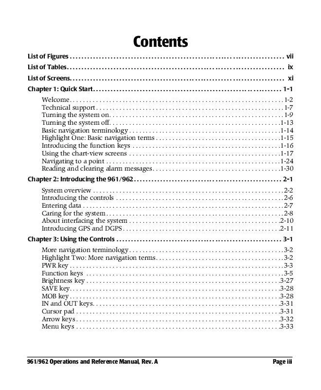
[. . . ] . 1-14 Highlight One: Basic navigation terms . . 1-24 Reading and clearing alarm messages. . 1-30 Chapter 2: Introducing the 961/962 . . 3-2 Highlight Two: More navigation terms. [. . . ] 961/962 Operations and Reference Manual, Rev. A Page 8-21
Chapter 8 - Creating Routes 4. At the SELECTED ROUTE POINT dialog box, press the EDIT key. Press the CURSOR PAD to move the waypoint to the desired location, then press the DONE key (or press CANCEL to leave the waypoint unchanged). The location of the moved route waypoint is displayed.
Graphically adding waypoints to a route leg
1. On the ROUTES screen, press the CURSOR PAD up or down to select the desired route. To display the route on the CHART screen, press the ON CHART key, then press the CHART key. At the CHART screen, press the CURSOR PAD to select the desired leg of the route. The name of the selected route and the particular leg must appear in the CURSOR INFO BAR at the bottom of the screen; to highlight the route leg, you may have to press the LEFT ARROW and RIGHT ARROW keys. Press the CURSOR menu key, then press the EDIT key. Press the CURSOR PAD to move the cursor to the desired location. If desired, you may select a named waypoint. As you move the cursor, a light gray line indicates the location of the new legs to and from the new waypoint. To insert the new waypoint at the cursor position, press the DONE key. The CHART screen appears, showing the route leg's new unnamed point (called POINT X in the CURSOR INFO BAR). To add waypoints to the same route leg or different route legs, repeat steps #3 through #6.
Graphically adding waypoints to the end of a route
1. On the ROUTES screen, press the CURSOR PAD up or down to select the desired route.
Page 8-22
961/962 Operations and Reference Manual, Rev. To display the route on the CHART screen, press the ON CHART key, then press the CHART key. Press the CURSOR PAD to move the cursor to the position where you want to store the route's new end point. Press the CURSOR menu key, then press the STORE AS WAYPT/ROUTE key. If desired, enter a name for the new waypoint; otherwise, the name defaults to starting sequentially as W0000. The CHART screen appears, showing a connecting route leg from the old end point to the new end point. [. . . ] A
Index warranty
1-8
Setting up your 961/962
chart CDs, loading, updating, and deleting 13-35 chart screen, changing setup 3-13 charts, managing 13-63 ClearZoom, selecting best, better, or off 13-28 clock, changing to a 12- or 24-hour clock 13-3 cross-track limits (cross-track scale), changing 13-3 cursor pad 13-27 datum in use, changing from auto to manual 13-11 DGPS and GPS, changing receiver setup 3-14, 14-4 display setup, changing 3-12 distance and bearing, selecting circle route or rhumb line 13-23 distance and speed, changing units 13-4 distance precision, selecting high or normal 13-5 distance scale, turning on or off display 13-34 echo sounder, changing setup 3-14 legs (past legs), turning on or off display 13-35 loran GRI, changing preferred 13-20 loran/phantom loran, turning on or off display 13-33 magnetic variation, selecting auto or manual calculation 13-22 navigation setup, changing 13-10 navigation, changing setup 3-13 NOC, entering 13-62 orientation, changing 13-28 ports, changing setup 3-15 range rings, turning on or off display 13-34 security system, setting up 13-7 steering (XTE), selecting circle route or rhumb line 13-23 tide-height, changing units 13-5 time zone, changing 13-3 update regions, turning on or off display 13-35 user permit, entering 13-62 vessel predictor line, changing length or turning off 13-33 waypoints, changing the maximum number of saved waypoints 13-6 waypoints, enabling or disabling symbols 13-25 waypoints, selecting auto advance or manual switch 13-20 waypoints, turning on or off display 13-26
Page I-18
961/962 Operations and Reference Manual, Rev. See Turning the 961/962 off Signal, definition of 5-5 Signal-to-noise ratio
definition of G-7 displaying 5-3, 5-5
SNR. See Speed-over-ground Specifications
Speed averaging value 5-2 Speed-over-ground (SOG)
DGPS antenna (AN205-P) A-8 DGPS receiver A-5 echo sounder A-4 GPS antenna (AN150) A-8 GPS receiver A-4 hardware A-6 interfacing A-6 navigation A-1 position specifications A-2 steer screens A-2 storing/sorting avoidance points, waypoints, routes, tracks trip A-3 waypoint and route storage A-2 waypoints A-3 accuracy of 5-4 definition of 1-15 displaying 4-15, 5-2, 10-6 troubleshooting 14-5
A-2
Star function key. See Turning the 961/962 on Station coverage bar 4-11, 4-13, 12-15, 12-16, 12-18 Steer function key. [. . . ]


 NORTHSTAR 962 Quick Start (63 ko)
 NORTHSTAR 962 Install Guide (3977 ko)
